Tenerife guide
How to visit Teide and understand what you are looking at
A visit to Teide goes well or goes flat for fairly predictable reasons: clothing, timing, altitude and expectations. This piece gathers what actually shapes the day, plus enough context for the landscape to stop being merely spectacular and start making sense.
First things first: this is not a viewpoint, it is 2,000 metres
Teide National Park occupies the high centre of the island. It runs from the Canary pine forest, at around 1,600 metres, up to the summit of Teide, the highest point in Spain at just over 3,700 metres. It was declared a national park in 1954 and UNESCO added it to the World Heritage List in 2007.
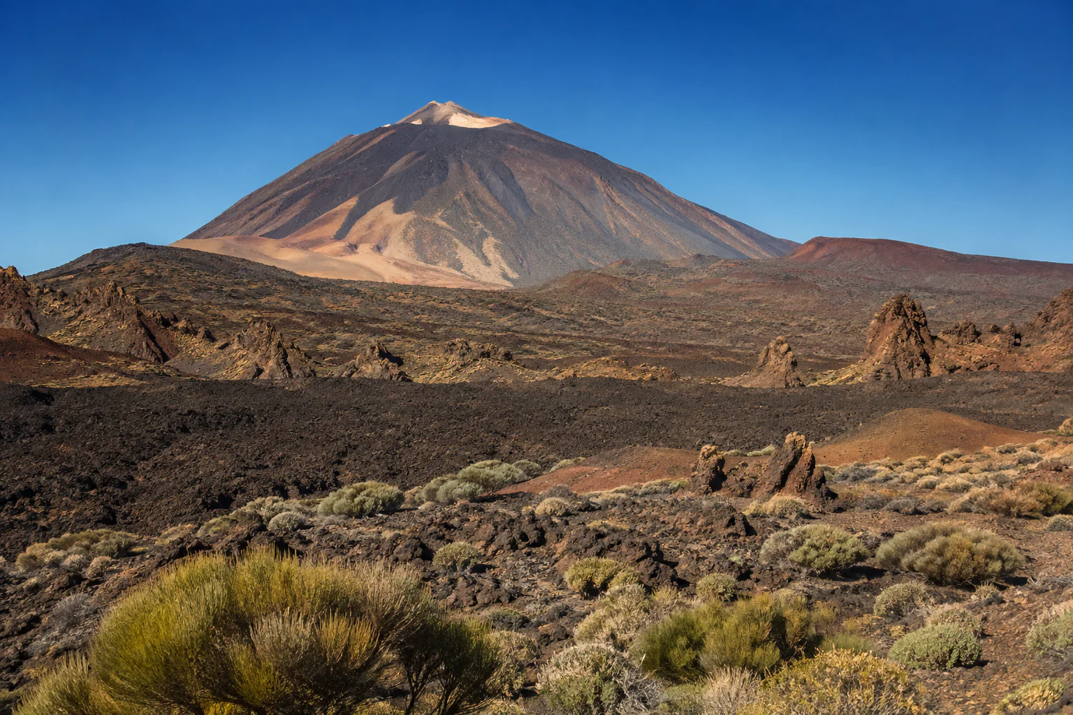
In practice, the road drops you onto an inland plain sitting at roughly 2,000 to 2,200 metres. The climate up there is a different climate: dry, with sharp contrasts between day and night, frequent wind and little rainfall, though snow is possible in winter.
The most common mistake I see is arriving in coastal clothing. In summer, someone leaving a twenty-five-degree beach turns up in a t-shirt and meets wind and a drop of fifteen degrees in wind chill the moment the sun goes down.
What to bring, no exceptions
- Layers and a windproof jacket. Even if it is warm below. Even in August.
- High-factor sun protection, sunglasses and something for your head. Radiation is stronger at altitude and it deceives you, because the air feels cool.
- Water. The air is very dry and dehydration creeps up on you.
- Closed shoes with grip, if you plan to leave the car and walk. The ground is uneven and loose.
- Hat and gloves in winter, if you will be standing outside.
When to go
Early morning brings fewer people, less accumulated haze and better light on the landscape. Usually less wind, too.
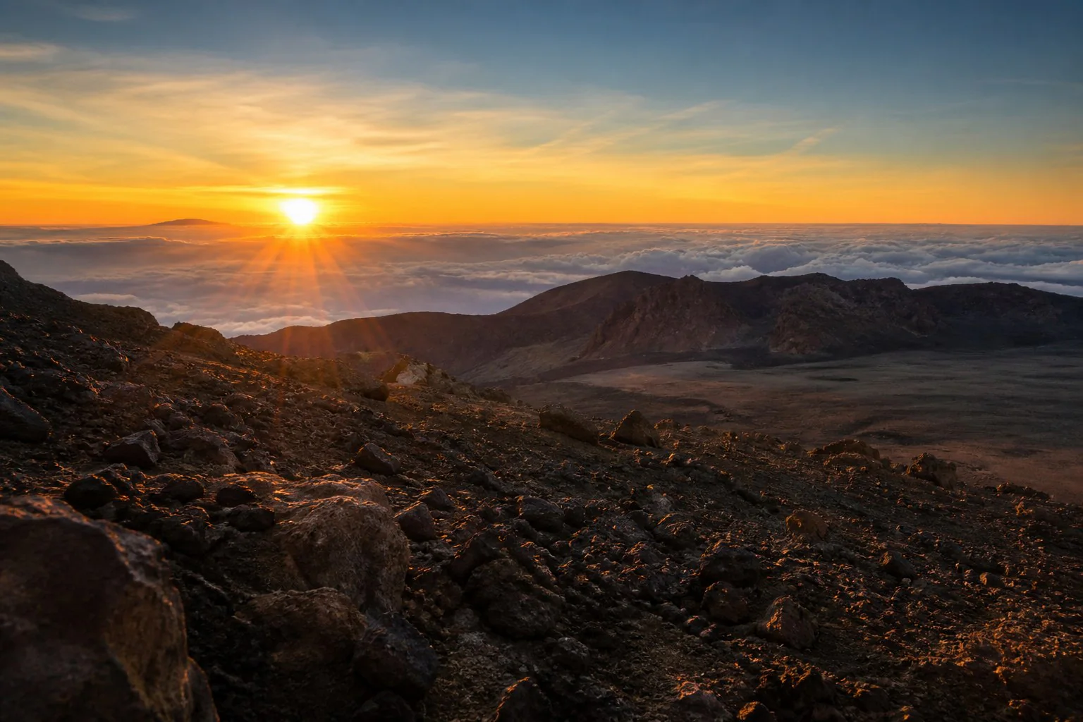
Late afternoon transforms the colour of the rock, and the sea of clouds, when it is there, sits below you. UNESCO mentions it explicitly when describing the park’s value: that blanket of cloud is part of the recognised landscape, not an anecdote. It appears often, but not always.
At night the interest is different: the sky. I cover that in the astronomy piece.
By season: winter can bring snow and temporary access closures; spring brings the broom into flower and, in good years, the red tajinaste; summer leaves the landscape arid and the afternoons very bright; autumn usually offers good stability.
Getting there and parking
You reach the park on mountain roads from four different directions, depending on whether you are in the south, the north, La Laguna or the west. Real journey times are longer than the map suggests: allow well over an hour from most resort areas, and expect continuous bends.
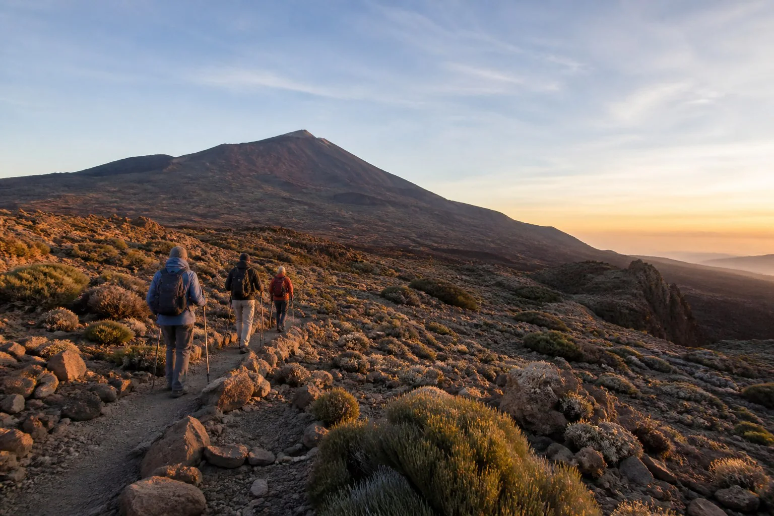
Two practical warnings:
- If anyone gets carsick, put them in the front and keep them off their phone. This drive brings it out.
- Parking at the best-known spots fills up by mid-morning, especially in high season. If you are going independently and want a specific stop, go early.
There is also a general conservation point the park itself makes: the less vehicle pressure, the better for the place.
What needs no paperwork
Most of a visit requires nothing at all: driving the interior road, stopping at viewpoints, visiting the visitor centres, walking freely accessible trails and taking in the volcanic landscape at your own pace.
For a first visit, that is already plenty. The park’s interior is an enormous caldera ringed by an escarpment, with the Teide–Pico Viejo volcanic complex at its centre, lava flows of different ages, secondary cones and a colour range running from black through ochre to white.
What does require a permit or booking
This is where people get caught out, so it is worth knowing before you travel:
- The summit of Teide. The final stretch from La Rambleta to the crater, the Telesforo Bravo trail, requires a permit issued through the national parks booking office. It is free but limited, and it tends to be taken months ahead.
- Several high-mountain trails in the park require prior booking through the Cabildo of Tenerife’s system. These are difficult routes with equipment requirements.
- The cable car runs on tickets and depends on the weather: it can close at short notice in wind.
All of this changes over time, so check the official source before you travel, not a blog. It is exactly what I do before every departure.
How to read the landscape
Three things that change the visit:
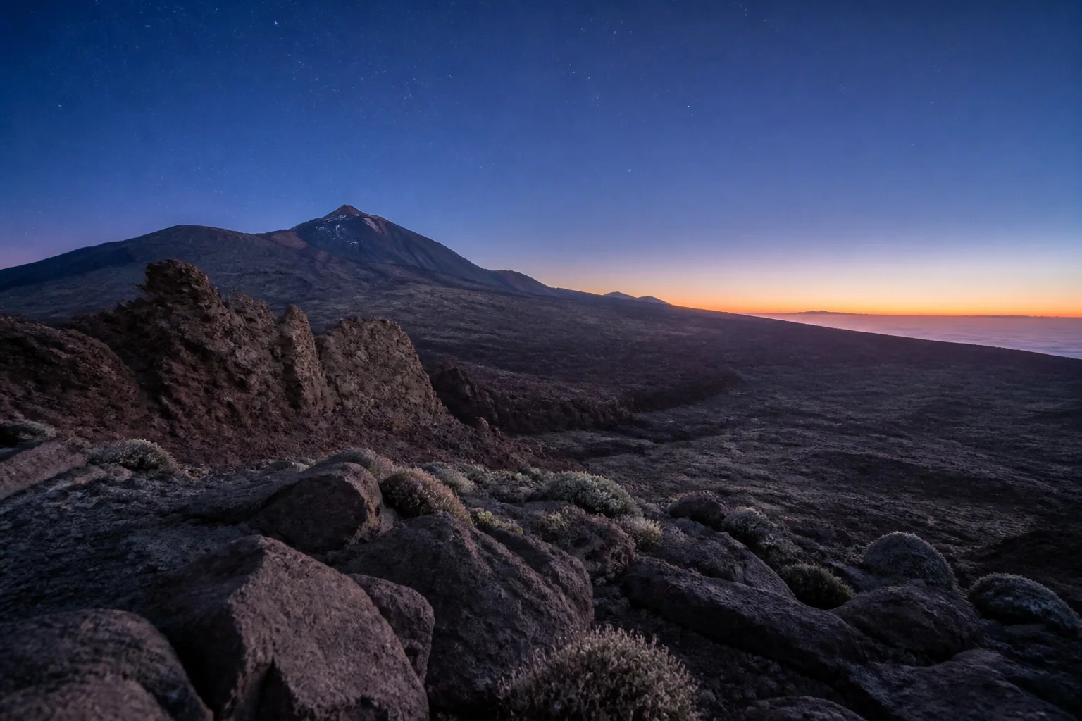
The caldera is not a crater. The escarpment ringing the inland plain is what remains of an earlier and far larger volcanic edifice that collapsed. What you see from the centre is the wall of that old structure.
Colour tells you age. Black, rough lava flows are recent in geological terms; those covered in vegetation or smoothed by erosion are older. You can put the landscape in chronological order just by looking.
The vegetation is an extreme case of adaptation. Plants grow here that exist nowhere else, adapted to heavy radiation, little water and sharp temperature swings. Broom dominates the summit scrub; the red tajinaste and the Teide violet are the examples everyone remembers.
Common mistakes
- Going up without warm clothing. I have now said it twice. It is number one.
- Treating the cable car as a certainty. It closes in wind fairly often; have a plan B.
- Assuming you can reach the summit without a permit. You can ride up to the upper station and walk the trails from there, but the final stretch to the top needs authorisation.
- Going at midday in August. Maximum crowds, maximum radiation, worst light.
- Staying in the car. The park makes sense once you get out and walk, even for twenty minutes.
- Not checking the wind forecast. At altitude, wind matters more than temperature.
Frequently asked questions
How much time do I need? Half a day is enough for a first pass with stops. A full day allows a walk and staying for sunset.
Is it suitable for children? Yes, with the usual precautions around altitude, sun and cold. What tends to strain them is the driving time, not the place.
Does the altitude affect you? For most people, very little on the inland plain. Above 3,000 metres it is another matter. Anyone with heart or respiratory conditions should check beforehand.
Can you see snow? On some winter days, yes. When it happens, access may be restricted for safety.
Is it worth it at night? Very much so, but for different reasons. See astronomy.
Is there anywhere to eat inside? Options are limited. If you are going independently, bring water and something to eat.
If you would rather have it explained on the spot
All of the above can be done independently with a good morning of preparation. If you would rather go up without driving and with someone explaining the landscape as you go, I guide private routes through the national park, in the afternoon and at night.
Read next: how to go stargazing in Tenerife and planning your trip.
Plan with clear information
Practical guides for planning your visit
Detailed answers to the questions worth settling before you plan the day.
More useful information
Keep planning your visit
Related guides to help you make informed decisions.
Qualifications, registrations and professional associations
Official Canary Islands Tourist Guide, Starlight Guide and low and medium mountain route guide.
- Official guideGTI-289
- Starlight Guideno. 40
- Low and medium mountainAFDA0611
- Active tourismTA-4-0026356.16
- Tourism intermediaryI-0005095.1
Registered active tourism activity with the current civil liability and assistance or accident insurance required by law.