Tenerife guide
Anaga and walking: choosing the right route
Anaga is where most people get their planning wrong in Tenerife. Not because it is dangerous, but because it is underestimated: you look at a map, see it is half an hour from the city and set aside an afternoon. Then it turns out the roads are narrow and slow, the mist changes everything, and the trail you found online takes three hours with serious ascent.
This piece is about choosing well before you go.
What Anaga is
A mountain massif at the north-eastern tip of the island, geologically much older than Teide. It was declared a rural park in 1994 and recognised by UNESCO as a Biosphere Reserve in 2015. It holds one of the highest concentrations of endemic species in Europe.
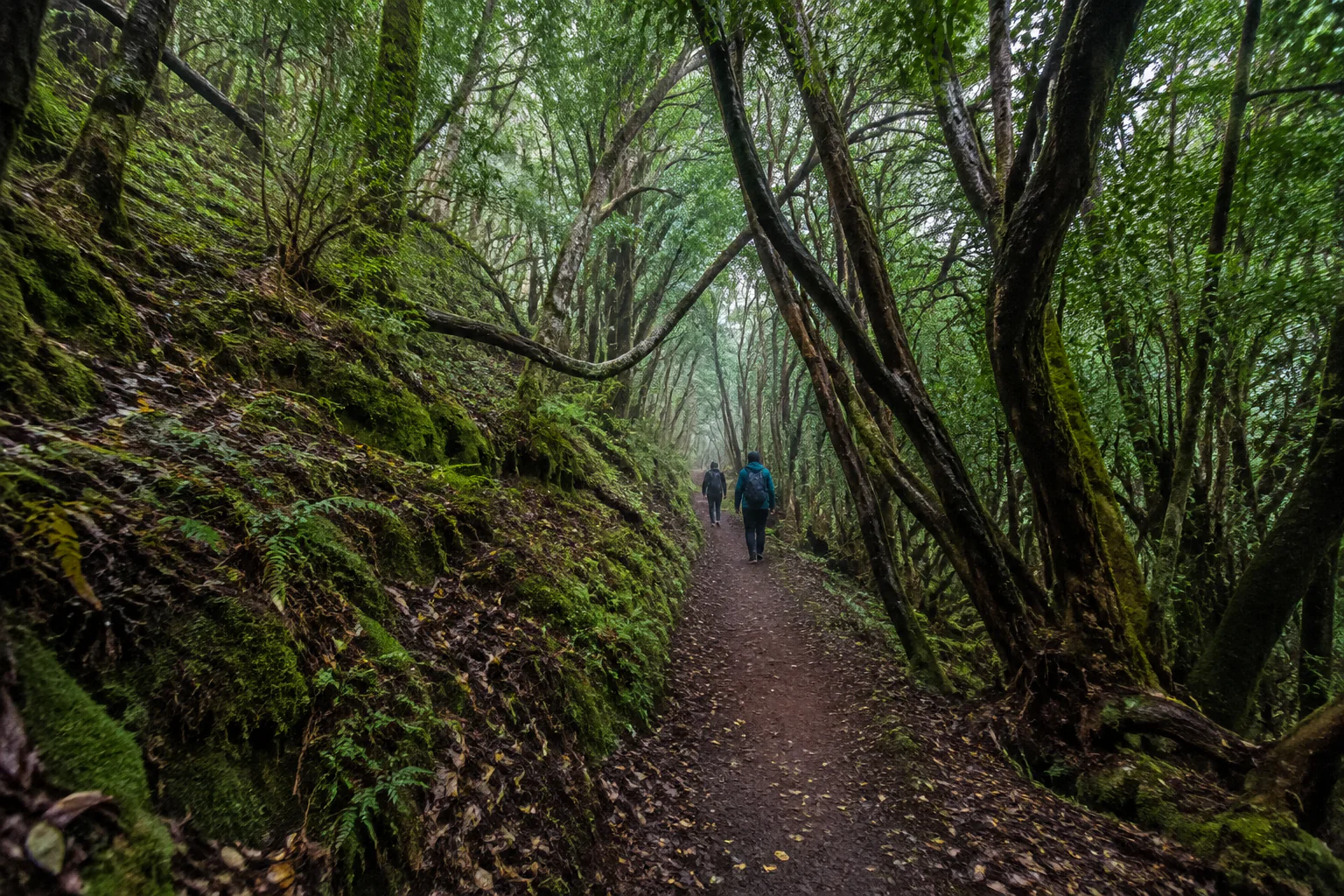
What makes it singular is the laurel forest: a humid woodland that once covered much of southern Europe and survives here thanks to the trade winds. The moisture they carry condenses on the leaves and drips to the ground. It is a forest that effectively waters itself from mist.
That is why Anaga is green on a dry island. And it is why the mist — which many visitors treat as a nuisance — is in fact the reason the place exists.
Stroll, trail or serious route: not the same thing
The word "hike" covers very different realities. Before choosing, place your group:
A stroll. Short, well-surfaced routes under an hour with no meaningful ascent. Suitable for almost any group, including families with small children and people unused to walking.
An easy or moderate trail. One to three hours, with real ascent, uneven ground and often roots and wet rock. Requires proper footwear and some walking habit, but no special preparation.
A demanding route. Several hours, significant ascent, exposed sections or long descents to the coast that then have to be climbed back or solved with transport. Here you need to know what you are doing.
The classic error is picking the third category thinking it is the second. Anaga has beautiful routes down to the sea; what is not always calculated is how you get back.
How to choose your route
Four questions, in order:
1. Who is walking? The least experienced person in the group sets the level. Always.
2. How much time do you genuinely have? Subtract the drive. From the south of the island, reaching Anaga takes considerably longer than the map suggests, and the roads within the massif are narrow with continuous bends.
3. Circular or linear? A linear route ending far from your starting point means solving the return. If you are independent and in one car, this matters a lot.
4. Does it need authorisation? Some Anaga routes have restricted access and require prior booking with the relevant authority. Check before counting on them.
What you need to know about the mist
In Anaga, mist is not bad weather: it is the forest’s normal climate. It can arrive and clear within half an hour, and it changes the experience entirely.
The good: the forest in mist is what people remember. Filtered light, dripping leaves, silence. In full sun, the laurel forest loses a lot.
The bad: the viewpoints. In thick mist, the coastal views vanish. If you are going for viewpoints, check the forecast; if you are going for the forest, mist works in your favour.
The practical: driving in mist on narrow roads means going slowly, and the forest floor becomes slippery.
What to bring
- Closed shoes with good grip. The single most important item. Roots and wet rock are slippery.
- A light waterproof or windproof jacket. Even if the south is at twenty-five degrees.
- Water and something to eat. Facilities inside the rural park are limited and the villages are small.
- Layers. There is a real difference between a windy viewpoint and the forest interior.
- A downloaded or paper map. Mobile coverage is not reliable across the massif.
The villages and the coast
Anaga is not only forest. Small communities live in the massif, in hamlets that were linked for centuries by footpaths, with subsistence farming adapted to impossible gradients. Follow the ravines down and you reach a coast of dark sand beaches and fishing villages.
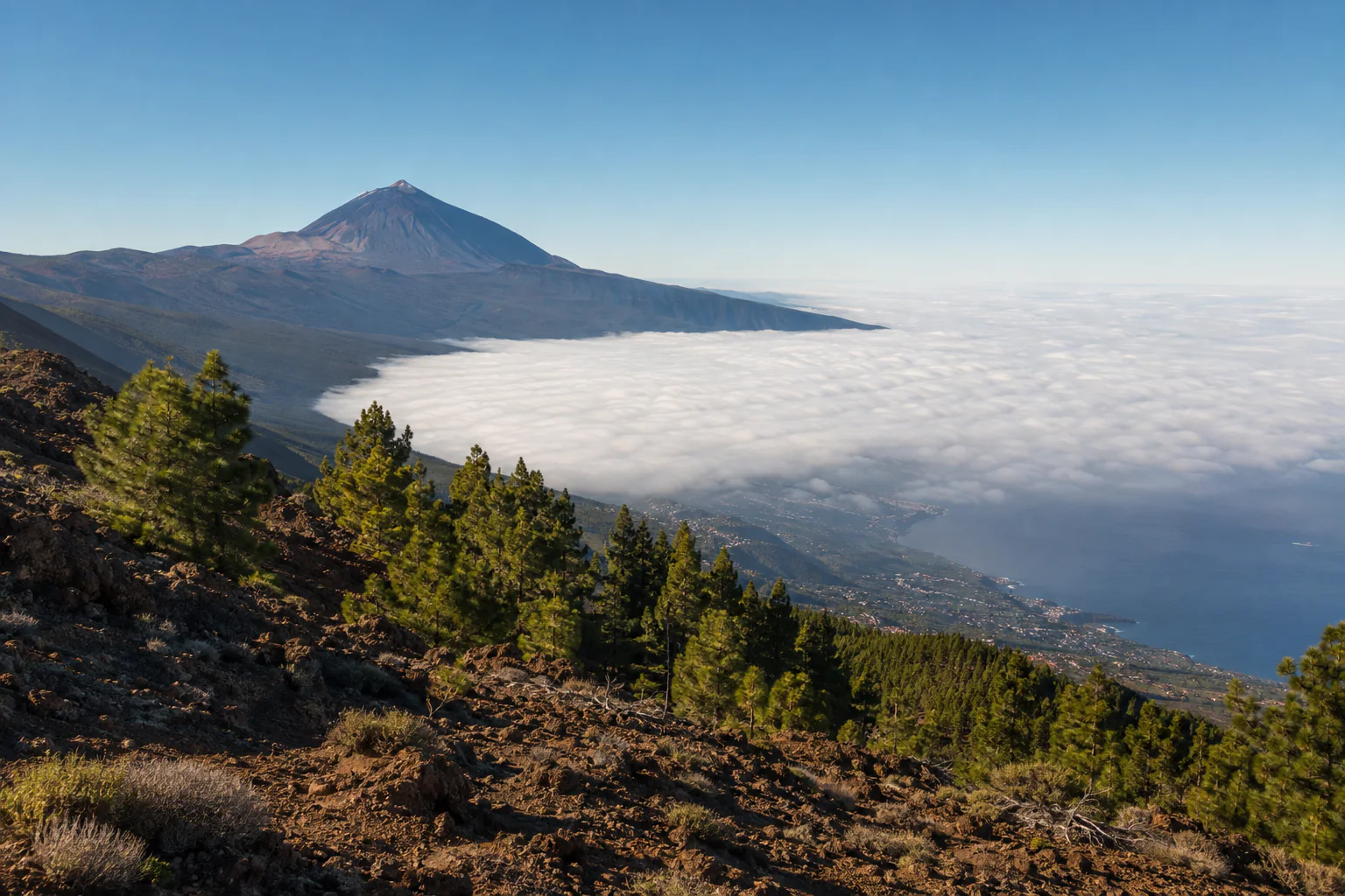
That contrast — humid forest above, dry wind-beaten coast below, within a few kilometres — is what makes the place hard to summarise. It is also why people returning to Tenerife put it on their second list.
If you visit the villages, one note: they are lived-in places. Parking properly, not blocking access and keeping the volume down are part of the visit.
Common mistakes
- Estimating time from a road map. Multiply it.
- Choosing the route from photographs. Photographs do not show the climb back.
- Wearing street shoes. The number one cause of near-misses.
- Counting on a restricted route without checking access.
- Planning Anaga and Teide on the same day. Opposite ends, opposite climates. It fits on the map, not in the day.
- Being put off by mist. That is the forest working.
Frequently asked questions
Can you visit Anaga with children? Yes, choosing short, surfaced routes. The upper area has options that work well with families.
How much time do I need? Half a day allows a short walk and a couple of viewpoints. A full day adds a village and a descent to the coast.
Do you need to book to walk in Anaga? For most routes, no. Certain specific paths do have restricted access and require prior booking. Check the Cabildo of Tenerife’s official channels before going.
Can it be done in a hire car? Yes, but expect narrow roads, continuous bends and scarce parking at popular spots. If that kind of driving worries anyone in the group, it is a good reason not to drive yourselves.
What is the difference between laurel forest and fayal-brezal? Laurel forest is the mature cloud forest, with large glossy leaves. Fayal-brezal is a more open, tougher formation that occupies ridges and wind-exposed areas. You cross from one to the other in a few metres and you notice it.
Do I need a mountain guide? For the routes described here, no. For technical or high-mountain hiking, yes: a professional qualified for that specific activity.
If you would rather go with someone
I guide a private day that combines the historic centre of La Laguna, a walk in Anaga agreed with your group, and a food stop. The walking stretch adapts to your real pace, not the other way round.
See La Laguna, Anaga and a guachinche
Read next: what to see in La Laguna and planning your trip.
Professional assurance
An experience prepared with the right qualifications
Daniela is a qualified low and medium mountain route guide (AFDA0611) and provides the activity as a registered active tourism operator (TA-4-0026356.16), with the required insurance in force.
More useful information
Keep planning your visit
Related guides to help you make informed decisions.
Qualifications, registrations and professional associations
Official Canary Islands Tourist Guide, Starlight Guide and low and medium mountain route guide.
- Official guideGTI-289
- Starlight Guideno. 40
- Low and medium mountainAFDA0611
- Active tourismTA-4-0026356.16
- Tourism intermediaryI-0005095.1
Registered active tourism activity with the current civil liability and assistance or accident insurance required by law.